From its biblical connections to its archaeological treasures, Ararat Province remains a symbol of Armenian heritage and identity.
One of the most renowned regions in Armenia, Ararat Province holds a significant place both historically and geographically. Located in the central part of the country, it shares borders with Turkey to the west and Azerbaijan to the south. The province offers breathtaking views of the legendary Mount Ararat, a symbol of Armenia, and the picturesque Ararat Valley, making it one of the most scenic areas in the country.
- Geography and Landscape
- Historical Significance
- Cultural and Religious Heritage
- Fortresses and Archaeological Sites
- Nature and Wildlife
- Population and Ethnic Diversity
Geography and Landscape
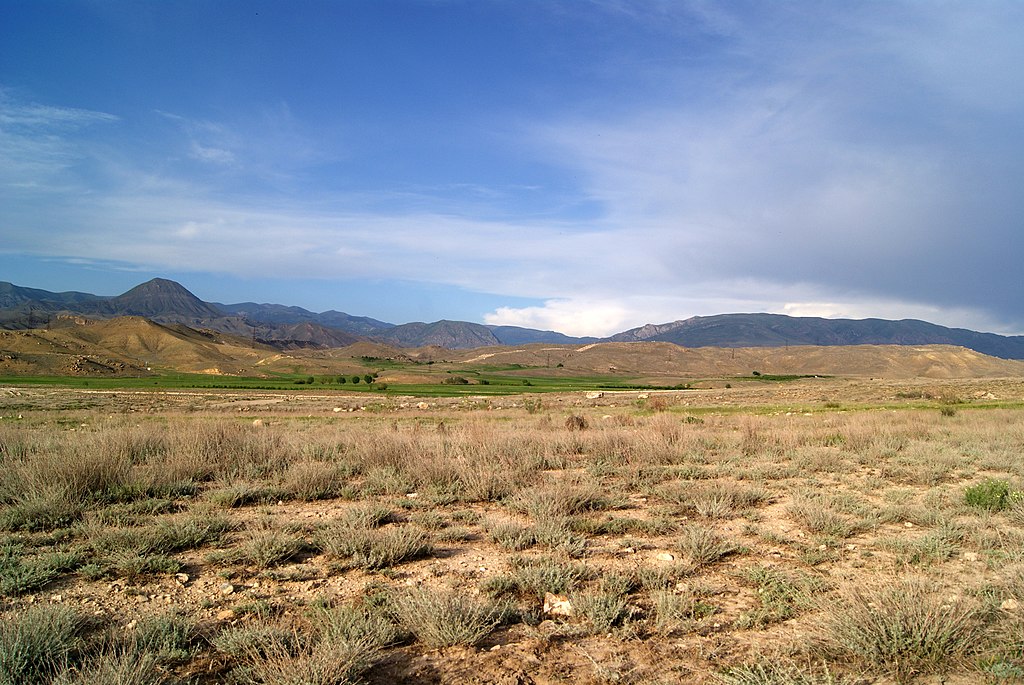
Ararat Province is a land of diverse landscapes, where 30% of the territory is covered by plains, while the rest is dominated by mountains. The region is surrounded by several mountain ranges:
- Yeranos Mountains to the north
- Gegham, Dahnak, and Mzhkatar Mountains to the east
- Urts Mountains to the south
- Araks River to the west, forming a natural border with Turkey
The province’s highest peak is Spitakasar (3,560 meters), part of the Gegham Mountains, while its lowest point is 801 meters in the Araks Valley. The Araks, Hrazdan, Azat, and Vedi rivers are the main waterways flowing through the province.
The climate varies dramatically, ranging from extremely arid conditions in the lower plains to cold, snowy weather in the mountainous areas.
Historical Significance
Ararat Province is steeped in history, with settlements dating back to ancient times. The province was primarily part of the Vostan Hayots canton of Ayrarat province in Ancient Armenia.
Two of Armenia’s former capitals are located here:
- Artaxata – Once a thriving political and cultural center of Armenia
- Dvin – Famous for its archaeological significance and ancient ruins
Cultural and Religious Heritage
Ararat is home to some of the most important religious and historical landmarks in Armenia.
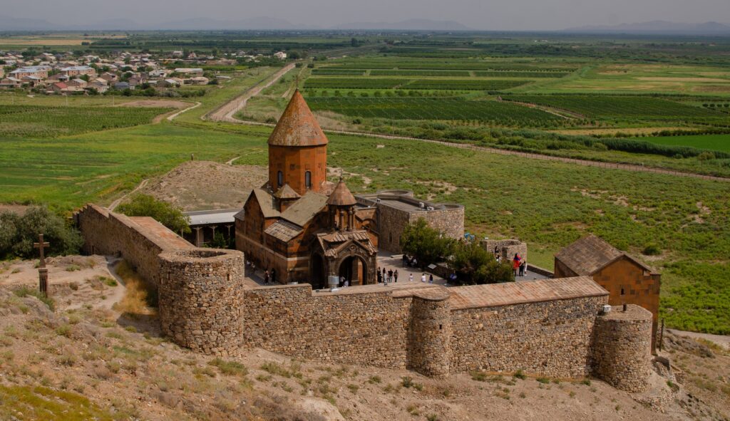
One of the most visited sites in Armenia, Khor Virap Monastery is where Saint Gregory the Illuminator was imprisoned for 13 years before converting Armenia to Christianity in 301 AD, making it the first country to adopt Christianity as a state religion. The monastery is also the closest accessible point to Mount Ararat from Armenian territory, offering stunning views.
Other Notable Monasteries and Churches
- Aghjots Vank (13th century)
- Hovhannes Karapet Monastery near Shaghap (13th century)
Fortresses and Archaeological Sites
Ararat Province boasts several ancient fortresses and archaeological sites, including:
- Ancient Artashat – The remnants of the former Armenian capital
- Ancient Dvin – One of the most significant archaeological sites in the region
- Kakavaberd Fortress (4th century)
- Tapi Fortress (10th century)
- Mausoleum of Kara Koyunlu Emirs in Argavand (built in 1413)
Nature and Wildlife
Ararat Province is home to several protected nature reserves, making it a haven for wildlife enthusiasts.
Khosrov Forest State Reserve – one of the oldest protected areas in the world, this reserve was originally established in the 4th century by King Khosrov III. It was once a stronghold for the endangered Caucasian leopards, and traces of these magnificent creatures were last recorded in the early 2000s.
Other Protected Areas
- Goravan Sands Sanctuary – A unique desert-like ecosystem
- Khor Virap Wildlife Sanctuary – Preserving the natural habitat surrounding the monastery
Population and Ethnic Diversity
The majority of Ararat’s population consists of ethnic Armenians, primarily following the Armenian Apostolic Church under the Araratian Pontifical Diocese.
However, there are also Assyrian communities, particularly in:
- Verin Dvin – Home to Assyrians belonging to the Assyrian Church of the East
- Dimitrov – Almost half the population is Assyrian
- Artashat – The provincial center also hosts a small Assyrian community
- The total Assyrian population in the province is estimated at around 2,500 people.